Geo 12: Demonstrate how maps and other geographic representations can be used to trace the development of human settlement from past to present.
Maps and other geographic representations can be used to trace the development of human settlement from past to present.
Explain why the Greek City-States were not united. How did the geography of Greece cause this to happen?
GEO 13: Describe how the geographic factors can promote or impede the movement of people, products, and ideas.
Cite examples of how the geography of Greece impacted the development of city-states.

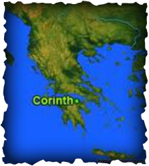
- The ancient city of corinth was founded in the 10th century B.C.
- Corinth had a problem with unemployment
- To solve this they created a successful public works program
- This gave people work, like building new aqueducts
- The boys were educated in the arts and sciences
- As a child kids were taught at home from the ages of 7-14
- Boys went to military school for at least 2 years
- Boys attended higher grade schools if their parents could afford it
- Literature,culture,art, and business thrived in corinth
- Corinth was a highly respected city state in ancient greece
- They made perfume and pots
http://odysseus.culture.gr/h/3/eh351.jsp?obj_id=2388